NYC History in the Palm of Your Hand


Have you ever wondered what the plot of land you live on looked like 30 years ago? How about where you work — have you thought about how that building might have changed over the past hundred years?
As long as you have a smartphone and access to the internet, you don’t have to wonder any longer.
OldNYC is both a website and a mobile app that allows users to access a map that can show what any part of New York City looked like at any given time since 1800. Dan Vanderkam, the website’s creator, developed and released the site in 2015.
Vanderkam, a Brooklyn-based software engineer, developed the OldNYC site as a side project over a span of three years, working whenever inspiration struck. His motivation was pure curiosity.
“I think people tend to look for places that they’re familiar with,” Vanderkam said. This includes himself — the former Google employee said he knew putting together OldNYC was going to be a fun endeavor when he started looking into the history of Google’s Manhattan office.
“I found photos of that building under construction in the 1920s,” he said. “It was pretty cool to see the context in which that very familiar building was built.” While previously living in California, Vanderkam had created a similar, albeit much smaller, site to showcase archived photos of San Francisco; once he relocated to New York, he decided to do the same with his new home. Vanderkam first turned to the New York Public Library for help with stockpiling historical photos of all five boroughs.
“With our help, Dan got access to high-resolution materials and access to our database,” said Bert Spaan, the NYPL Space/Time Directory engineer. “We gave him a list of all the photos, titles and descriptions of all the photos and with all that data, he made OldNYC.”
Of course, there were obstacles. In order to place the photos on the map, Vanderkam had to convert the photos’ locations, which came as cross streets, to latitudes and longitudes. This can be done easily with a geocoder — a system that converts postal addresses to numerical coordinates — but Vanderkam explained that because of urban growth, a lot of what existed back in 1800 isn’t around any longer.
“For obvious reasons, the geocoders that people have built are for contemporary streets; they’re not for streets in the 1920s and though the New York street grid hasn’t changed that much in the last hundred years, it has changed in some ways,” Vanderkam said. “I wrote out a list of some of the streets that had been renamed, or blocks that had been removed and figured out what those latitudes and longitudes would be, so you can actually see the photographs of some of these intersections that don’t exist anymore.”
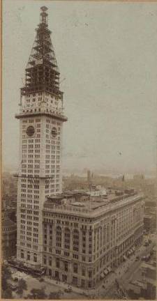
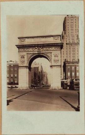
The interactive map of Manhattan holds nearly 40,000 archived photos. Click on any of the red dots on the map and you’re taken back in time as a yellowed photo pops on screen, a year and description hovering to the side. Scroll to Brooklyn to see photos of the Williamsburg Bridge under construction, or over to 350 Fifth Avenue for half of the Empire State Building. 333 Seventh Avenue, the towering building that now houses Straus News, was once a modest six story apartment building in 1914.
“One of the really great things is seeing photographs from the less developed places,” Vanderkam said. “If you look at photographs from out in Queens from the 1920s, it’s like farm fields, so those are some of the areas that have really changed a lot in New York over the last hundred years. I had no idea that parts of the city used to be so rural.”
After the website came the mobile version. The OldNYC app gives users the ability to access the history of any property in New York City at any given time; it’s a handy and convenient way to immediately compare the old with the new.
Although Vanderkam loves the app (in fact, he said he feels the app is superior to the website), he isn’t responsible for its creation. Those credits go to Orian Breaux and Christina Leuci, a couple who responded to the call for app developers Vanderkam made in an OldNYC newsletter email blast.
“I said, ‘If anyone out there is an iOS developer and wants to build an Old New York app, get in touch,’” Vanderkam explained. After Breaux, a product manager, and Leuci, a software developer, made contact, Vanderkam met with them to show them how to access the data.
“A few months later, they came out with the OldNYC app, which was pretty awesome because probably 90 percent of the time I show OldNYC to people now, it’s using that app,” he said. “So they really did a service to New Yorkers.”
Although Vanderkam released the site two years ago, he’s found that he’ll never quite be done updating the map as more photos are found and as he develops new techniques to smooth out minor glitches. Most recently, he added a time slider to the site — now users can narrow down their search to photos from specific years.
OldNYC is just one of the many archival tools that history buffs and researchers alike can look towards. The NYPL’s NYC Space/Time Directory offers a number of resources, including a searchable atlas of New York’s past, a historical location directory and geocoder and a discovery tool that links all of the NYPL collections together in historical and geographical context.